One Map, Many Messages: US Trade Post Reflects India’s Stand on PoK and Aksai Chin
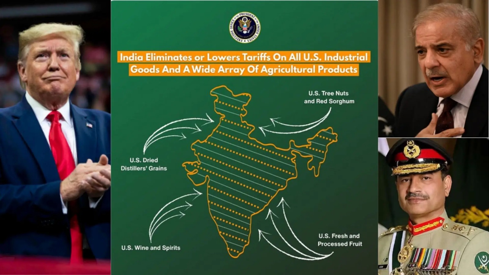
US | 7 Feb 2026 While the interim trade deal between India and the United States grabbed attention, it was a single image shared by Donald Trump’s trade representative that stood out. The map of India posted on X showed the entire Jammu and Kashmir region, including Pakistan-occupied Kashmir, as part of India. It also included Aksai Chin, a territory claimed by China, within India’s borders. This depiction matched India’s long-standing position on its territorial integrity. What made the map significant was the clear shift from past US practice. Earlier, maps released by US government agencies often showed Pakistan-occupied Kashmir separately. This time, no such distinction was made. Although India has always maintained that Jammu and Kashmir and Ladakh are its inalienable parts and do not need external validation, the move carries strategic weight and signals a change in US representation. The timing of this map is equally important. It comes as India-US relations are being recalibrated under President Donald Trump. Only months ago, the US had imposed steep 50 per cent tariffs on Indian goods. Under the new interim trade deal, these tariffs have been reduced to 18 per cent, among the lowest in Asia, and penalty tariffs linked to Russian oil imports have been removed. The map also appeared amid debate over Trump’s reported attempts to re-hyphenate India and Pakistan, a departure from earlier US policy. Trump has repeatedly claimed that he brokered a ceasefire between the two countries last year, a claim rejected by India’s Ministry of External Affairs, which insists such matters are bilateral. Adding another layer, defence analyst Major Gaurav Arya reacted sharply to the map, posting, "Full marks (to the US) for the map, though. Well done." For Pakistan, the timing could be uncomfortable. Despite increased diplomatic engagement with Washington and even nominating Trump for the Nobel Peace Prize, Pakistan now faces higher tariffs than India. Under the revised trade structure, Indian goods will be taxed at 18 per cent, while Pakistani goods will face a 19 per cent tariff, underlining the shifting dynamics in the region. One Map, Many Messages: US Trade Post Reflects India’s Stand on PoK and Aksai Chin Amid headlines about the interim trade agreement between India and the United States, one image quietly drew attention. A map shared by Donald Trump’s trade representative showed the full Jammu and Kashmir region, including Pakistan-occupied Kashmir, as part of India. It also placed Aksai Chin, claimed by China, within Indian borders, clearly reflecting India’s long-held stand on its territory. What made this notable was the break from earlier US practice. In the past, official American maps often marked Pakistan-occupied Kashmir separately. This time, there was no such separation. While India has always said its borders do not need approval from outside powers, the map still carried diplomatic meaning and hinted at a shift in approach. The timing of the post also mattered. It came as India-US ties were being reset after a difficult phase under President Donald Trump, when Indian goods faced a 50 per cent tariff. Under the interim deal, those tariffs have now dropped to 18 per cent, and extra penalties linked to Russian oil imports have been removed, easing trade pressure on India. The map appeared amid debate over Trump’s comments on India-Pakistan relations and his claim of arranging a ceasefire, which India has firmly denied. It also placed Pakistan in an awkward spot, despite its recent outreach to Washington. As defence analyst Major Gaurav Arya reacted, "Full marks (to the US) for the map, though. Well done." Under the new tariff structure, India now enjoys a lower rate than Pakistan, adding another twist to the regional picture.
