India Strengthens Arunachal’s Identity on Official Map
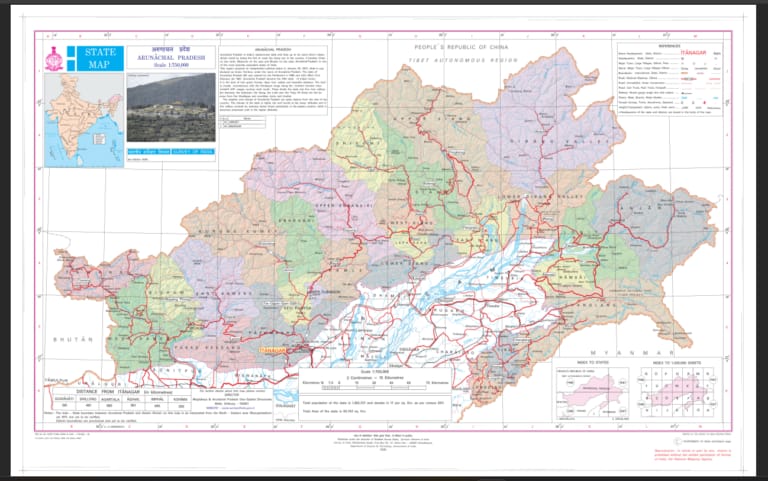
New Delhi, August 09, 2026 India has taken a significant institutional step to reinforce the identity of strategically important areas in Arunachal Pradesh and underline its position on national sovereignty. Under the Union Ministry of Home Affairs, and following consultations with the Arunachal Pradesh government, the Survey of India has incorporated 27 strategically important locations of the state into the country’s official map. The places have been recorded using their authentic local names, giving the move significance amid China’s repeated attempts to assign its own names to locations in Arunachal Pradesh. China has for years referred to Arunachal Pradesh as ‘Zangnan’ or ‘South Tibet’ and has periodically issued lists containing what India considers fabricated Chinese names for locations in the state. Its Ministry of Civil Affairs released names for six places in 2017, followed by 15 in 2021, 11 in 2023 and 30 more in March 2024. India has consistently rejected these exercises, maintaining that changing the names of places on paper cannot change the reality on the ground. Such efforts are widely described in strategic discourse as ‘cartographic aggression’, through which territorial narratives are sought to be reinforced through maps and official naming. Several locations included in the Survey of India map have a direct connection with the history of the India-China border dispute. Longju, situated close to the Line of Actual Control, is particularly significant as it witnessed a major confrontation between Indian and Chinese forces in 1959, three years before the 1962 war. Nearby Maja, in Upper Subansiri district, has also been included. Other strategically important locations include Thag La, along with the Namka Chu valley, where Chinese forces launched a major offensive against India on October 20, 1962. High-altitude passes such as Dzo La, Riza La and Pukur La have also been included because of their importance for surveillance, movement and patrolling by Indian security forces. The map also records locations associated with the sacrifices of Indian soldiers. Jaswant Garh, on the route to Tawang, commemorates Rifleman Jaswant Singh Rawat (Maha Vir Chakra), who displayed exceptional bravery during the 1962 war and resisted Chinese forces for 72 hours before attaining martyrdom. The Sher-e-Thapa Memorial has also been formally included, representing the courage of Subedar Trilok Singh Thapa and his unit in the Subansiri sector during the conflict. Another strategically significant location, Jairampur in Changlang district, plays an important role in the movement of security personnel and the transportation of rations and military supplies towards eastern Arunachal Pradesh and the Myanmar border. The inclusion of these 27 locations is therefore more than a routine cartographic exercise. By formally recording their recognised Indian names, India has strengthened the administrative and historical identity of these frontier areas while documenting their strategic importance. The move also sends a clear institutional message that attempts to establish territorial claims through unilateral renaming cannot alter established realities. Through its official mapping system, India has reaffirmed the historical, administrative and strategic significance of its border regions.