UN Adopts Resolution to Phase Out Mercator Map in Favour of Equal Earth Projection
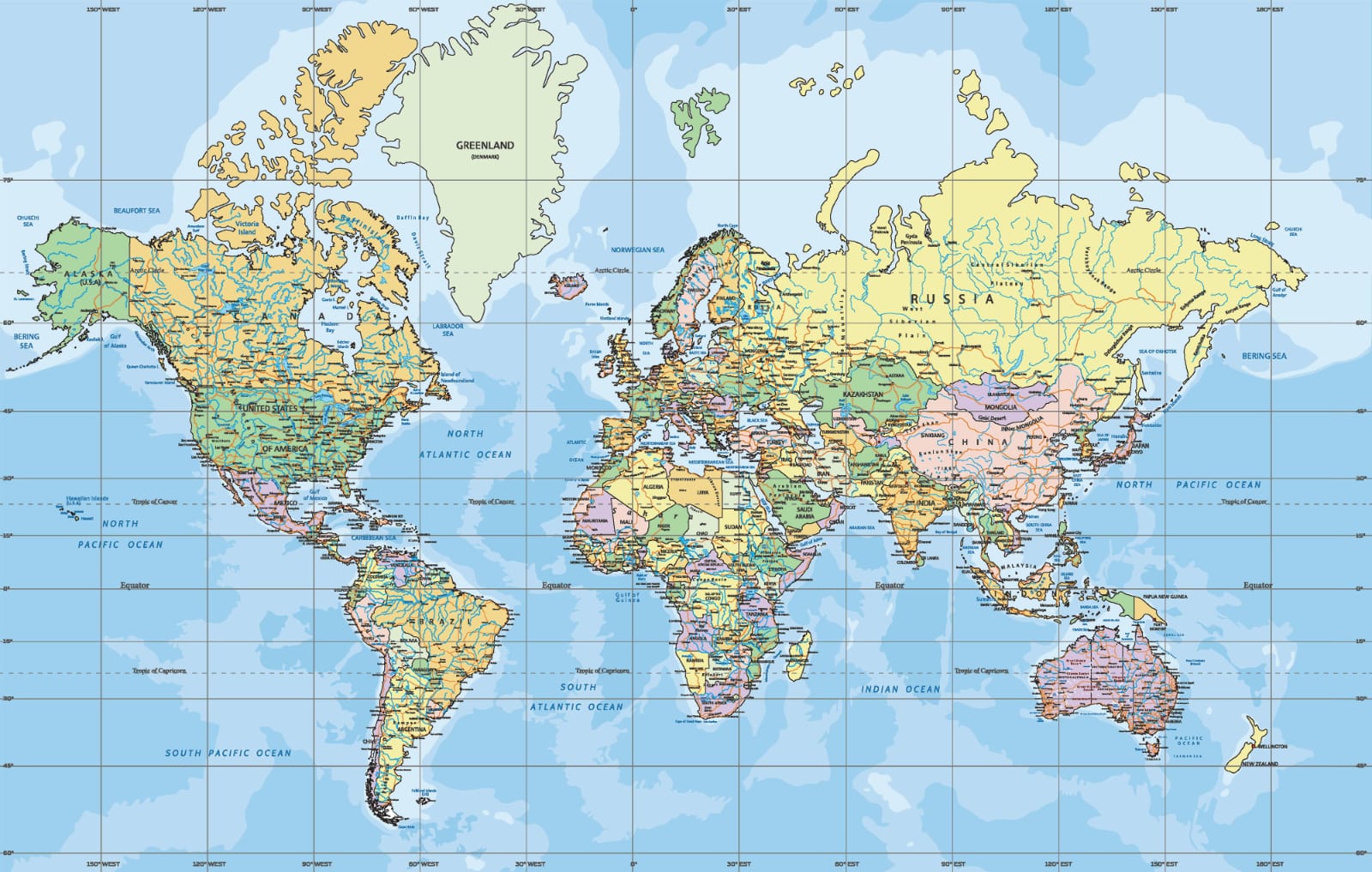
New Delhi, September 06, 2026 The United Nations has backed a major shift in how the world is represented on maps, adopting a resolution to move away from the centuries-old Mercator projection in favour of the 2018 Equal Earth design. The new projection is considered more accurate in showing the true relative sizes of continents, particularly Africa. The resolution was adopted at the UN headquarters in New York, with 164 countries voting in favour. The United States was the only country to vote against it, calling the move “superfluous”, while six nations abstained. Although the resolution is non-binding, it could influence school curricula, technology platforms and institutions that continue to use the Mercator projection. Created by Gerardus Mercator in 1569 for maritime navigation, the projection remains widely used but significantly distorts land sizes. Areas near the poles appear larger, while regions around the equator look smaller. Africa, for example, may appear similar in size to Greenland despite being around 14 times larger. Togo, which led the campaign for the African Union, said such representations have had lasting effects on how Africa and other regions are perceived. Foreign Affairs Minister Robert Dussey said: “This discussion is not a political discussion [but] a scientific discussion, because there is scientific proof so we all have to accept the reality.” The #CorrectTheMap campaign, endorsed by the African Union in August 2025, has promoted the Equal Earth projection as a way to correct these long-standing distortions. Critics have described the issue as “cartographic colonialism”, arguing that conventional maps have visually reduced the Global South while enlarging northern regions. France has also backed a move away from Mercator maps, with Foreign Minister Jean-Noël Barrot saying: “[We] will abandon the Mercator projection in favour of map representations tailored to specific uses, more faithful to actual surface areas and in line with the recommendations of cartographers and scientists.” Togo now plans to hold an event in Lomé with Unesco, the African Union and technology brands, including Google Maps, to discuss the resolution's implementation. While the UN decision does not ban the Mercator map, supporters believe it could reshape how future generations understand the world's geography. As Dussey said: “To those who say why now, I say: why not? When we look at the world map … it is time for us to change the narrative.”